Please see below for descriptions of my current research and completed projects:
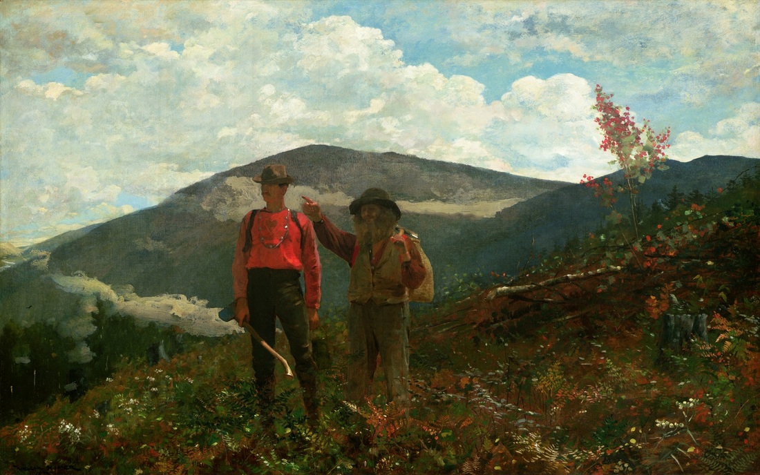
Two Guides (1877) | Winslow Homer
|
New Research in the Adirondack Mountains and Tug Hill Plateau!
I am just spinning up some projects in the Adirondack Mountains of New York. At the moment (Summer 2015) I am working in tandem with a Washington & Lee undergraduate to investigate the imprint of Laurentide glaciation on the fluvial geomorphology and drainage network development of the Tug Hill Plateau west of the Adirondacks. Other future projects include: -The role of beaver in the sediment and carbon budgets of small catchments within the Adirondacks -Sediment cores of Adirondack ponds to link upland sediment sources to upland sinks. Also in pursuit of legacy sediment related to Adirondacks logging and iron smelting in the mid-to-late 19th century. -Pursuing more evidence for recent, active uplift in the Adirondacks recorded by geodesy and river long profiles -Refining the story of proglacial lakes and outburst floods in the Black River Valley west of the Adirondack Mountains (also working on this last one right now) |
|
Post-Tectonic Landscape Evolution of Southeastern Arizona's Basin and Range
I am investigating the post-tectonic landscape evolution of southeastern Arizona’s Basin and Range physiographic province. I use cosmogenic nuclide geochronologic techniques to constrain the pace and pattern of the region’s transition from a series of internally drained structural basins into the modern, through-flowing Gila River network. In addition to providing numerical age constraints on Late Cenozoic sedimentary deposits in Arizona, the nature of cosmogenic nuclide techniques allows the quantification of paleo-erosion rates in the uplands during the final stages of sedimentary basin aggradation. As a result, I can investigate how upland erosion rates have varied in the region from the Late Tertiary through the mid-Pleistocene, a period of inferred dramatic climate change. For more information on my research in Arizona, please take a look at the mostly non-technical article I wrote for the Arizona Geological Survey's magazine, Arizona Geology: Post-Tectonic Landscape Evolution in Southeastern Arizona: When Did a River Start to Run Through It? Coming soon... Jungers, M.C. and Heimsath, A.M., accepted, Post-Tectonic Landscape Evolution of a Coupled Basin and Range: Pinaleño Mountains and Safford Basin Southeastern Arizona. Geological Society of America Bulletin. Jungers, M.C. and Heimsath, A.M., in prep, Drainage Integration as a Driver of Transient Erosion, Aravaipa Creek, AZ. |
For more information, please see: Jungers et al., 2013, EPSL [pdf, 4.16 MB]
|
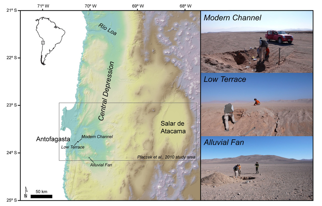
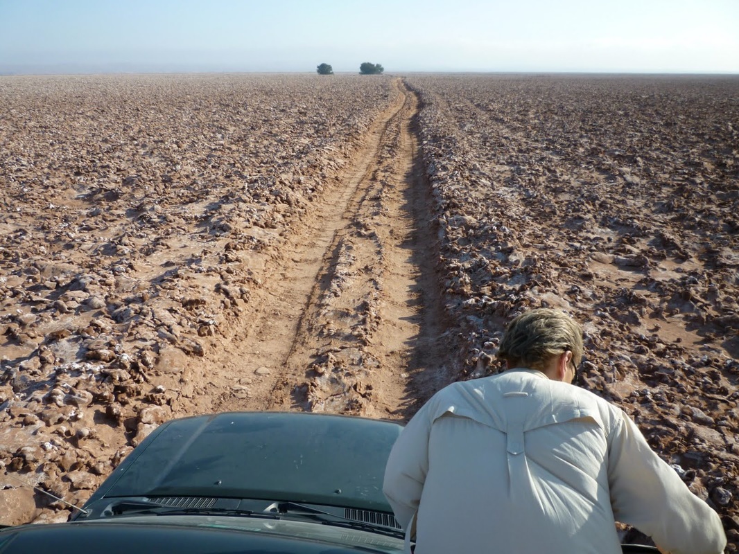
Active Erosion-Deposition Cycles in the Hyperarid Atacama Desert of Northern Chile
To quantify rates of fluvial processes in the Atacama Desert, we produced a dataset of in-situ produced cosmogenic 10Be and21Ne concentration depth profiles in alluvial sediments from the central Atacama Desert that include regional late Pliocene deposits and younger, localized Quaternary fluvial features inset into the regional Pliocene landforms. To interpret these data, we (1) compared surface concentrations of cosmogenic nuclides to depth profiles, (2) investigated the complexity of sediment exposure histories, and (3) used cosmogenic nuclides to quantify Quaternary deposition in active channels. In summary, depth profiles of two TCNs provide constraints on the rates of sediment deposition, sources of sediment and transport history, as well as the subsequent exposure conditions of the sediment following deposition. Our results are consistent with early Quaternary initiation of hyperaridity for the region. During the Quaternary, winter precipitation events experienced at our sites' latitude (24 S) drive active erosion–deposition cycles. The northward migration of the subtropical front during Quaternary glacial cycles may have enhanced precipitation at 24 S, leading to more active fluvial processes during cooler periods. |
|
Late Cenozoic Landscape Evolution of Northern Chile's Central Depression
(Atacama Desert) I am involved in ongoing research with Dr. Ronald Amundson investigating how surface processes have shaped Northern Chile's Central depression over the last ~10 Ma. We are combining studies of soil geochemistry, stable isotopes in paleosols, cosmogenic nuclide geochronology, remote sensing, and topographic analyses to investigate: - The timing and mechanism of the Rio Loa's drainage integration across the Coastal Cordillera - Uplift history of the Coastal Cordillera over the last 10 Ma - The onset of hyperaridity in the Atacama Desert - Soil development in a hyperarid climate - Modern and paleo-erosion rates in the Atacama Desert |
Jungers, M.C., Amundson, R., Heimsath, A., Christensen, P., and C. Edwards, 2010, "Ancient and Modern Salars of the Atacama Desert, Chile: A Terrestrial Analog for Evaporite Formation on Mars". EOS, Transactions of the American Geophysical Union.
|
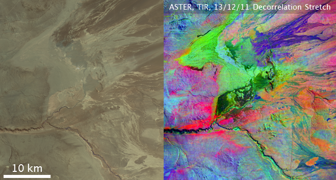
Ancient and Modern Salars of the Atacama Desert, Chile:
A Terrestrial Analog for Evaporite Formation on Mars The hyperarid (< 2 mm yr-1) Atacama Desert of northern Chile is widely accepted as a terrestrial analog for the surface of Mars. Sulfate and chloride deposits are present in uncommonly high abundance throughout the Atacama. The formation and maintenance of these evaporitic deposits are a direct result of the arid-hyperarid climate of the Atacama from the Triassic to the present. Remotely sensed data and analyses conducted during Mars landing missions have revealed the presence of sulfate and chloride deposits covering some portions of Mars’ surface. We synthesize remotely sensed (ASTER) data from the Atacama with field observations, samples, and sample analyses by portable XRF and laboratory thermal spectrometry to inform how best to interpret signatures of sulfate and chloride deposits on Mars. Preliminary results are promising regarding our ability to distinguish sulfates from chlorides using lab spectra. |
|
Tracing hillslope sediment production and transport with in situ and meteoric 10Be
I worked with Dr. Paul Bierman at the University of Vermont to quantify rates of sediment production and transport on steep hillslopes in varied climatic and tectonic settings around the world. I used in situ and meteoric 10Be as geomorphic tracers of surface processes and to quantify soil residence times on hillslopes. My study areas for this research included the Appalachian Plateau of Pennsylvania, the Waipaoa River on New Zealand's north island, the Oregon Coast Range, the central plateau of Madagascar, and the Great Smoky Mountains of Tennessee and North Carolina. To see the detailed results of my work in the Great Smoky Mountains, please see: Jungers et al., 2009, JGR Earth Surface [pdf, 712 KB] |
|
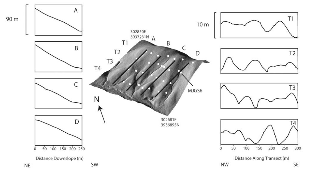
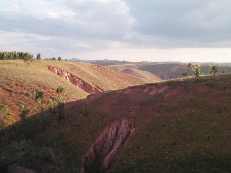
Erosion Rates and Sediment Sources in Madagascar
In 2005, I had the opportunity to assist Dr. Ronadh Cox with a project investigating background rates of erosion in Madagascar. We surveyed large erosional gullies, 'lavakas' in Malagasy, to better understand how they form and how much sediment they contribute to the broader sediment budget of central Madagascar. We also sampled hillslope sediment and river sediment for10Be analyses to quantify millenial scale erosion rates and define sediment sources. For more information on this research in Madagascar, check out Ronadh's Team Lavaka page and check out: Cox, R., Bierman, P., Jungers, M.C., and Rakotondrazafy. M., 2009, Erosion rates and sediment sources in Madagascar inferred from 10Be analysis of lavaka, slope, and river sediment, Journal of Geology, volume 117, p. 363–376, doi:10.1086/598945. [pdf, 572 MB] |